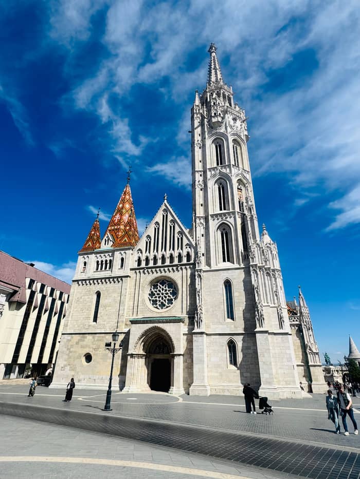
Large group
City landmarks walk
Pest centre on foot
- Length2 hours
- GroupUp to 30
- Inside visitsNone
Guides
Language
Currency
Check open spots€12 and up · free cancelPick out your stop
Budapest City Landmarks Walking Tour in 2 Hours
★ 4.9 · 2,406 reviews so far
In brief
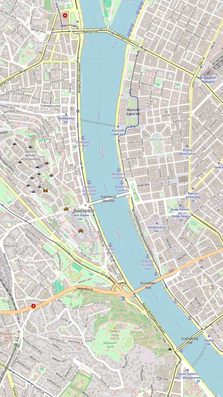
This Budapest walking tour map draws a loop from Vörösmarty tér past the basilica and the Parliament, along the river to the Chain Bridge, up Castle Hill by funicular or bus, and back to Pest over the Elisabeth Bridge.
Useful numbers
Browse 30 stops
Pick a route and tap a pin or a stop: you get its note and a Google Maps link.
Starting square of the self-guided loop, in the heart of Pest.
Google MapsBudapest's largest church, 96 meters high; 364 steps or a lift to the dome.
Google MapsHouse of Parliament, built 1885-1902; dome 96 metres.
Google MapsIron shoes remembering Jews shot into the Danube by the Arrow Cross.
Google MapsBuilt 1839-1849, blown up in 1945, reopened in 1949.
Google MapsSquare at the foot of Castle Hill with the funicular's lower station.
Google MapsRuns 08:00-22:00 between Clark Ádám tér and Szent György tér.
Google MapsAdult church ticket 3,400 Ft; knees and shoulders covered.
Google MapsA 140 metre facade of terraces facing the Parliament.
Google MapsThe largest public collection of Hungarian fine art, with a terrace over Pest.
Google MapsMiklós Ybl's riverside gardens, rebuilt between 2011 and 2014.
Google MapsBridge back to Pest, seen in a row with the Chain and Liberty bridges from the quay.
Google Maps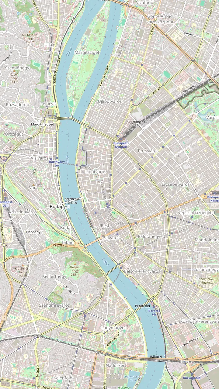
House of Terror at Andrássy út 60, closed on Mondays.
Google MapsUNESCO-listed square at the end of Andrássy út.
Google MapsWartime hospital and Cold War bunker, guided tours only, at Lovas út 4/c.
Google MapsFort on Gellért Hill; the Liberty Statue rises 40 metres with its pedestal.
Google MapsChurch in Gellért Hill whose entrance was walled up in the 1950s.
Google Maps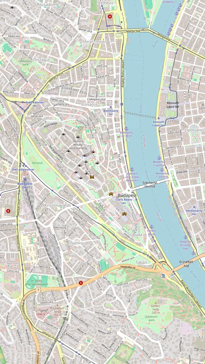
Meeting point for the long Buda Castle Cave tour, opposite Matthias Church.
Google MapsAdult church ticket 3,400 Ft; knees and shoulders covered.
Google MapsA 140 metre facade of terraces facing the Parliament.
Google MapsGate at the quiet northern end of the plateau, near the Medieval Jewish Prayer House.
Google MapsLone church tower at the north end of the hill; walk Táncsics Mihály utca to reach it.
Google MapsOfficial residence of the President of Hungary.
Google MapsRuns 08:00-22:00 between Clark Ádám tér and Szent György tér.
Google MapsAlajos Strobl's fountain of King Matthias, lit in colour after dark.
Google MapsThe largest public collection of Hungarian fine art, with a terrace over Pest.
Google MapsMiklós Ybl's riverside gardens, rebuilt between 2011 and 2014.
Google Maps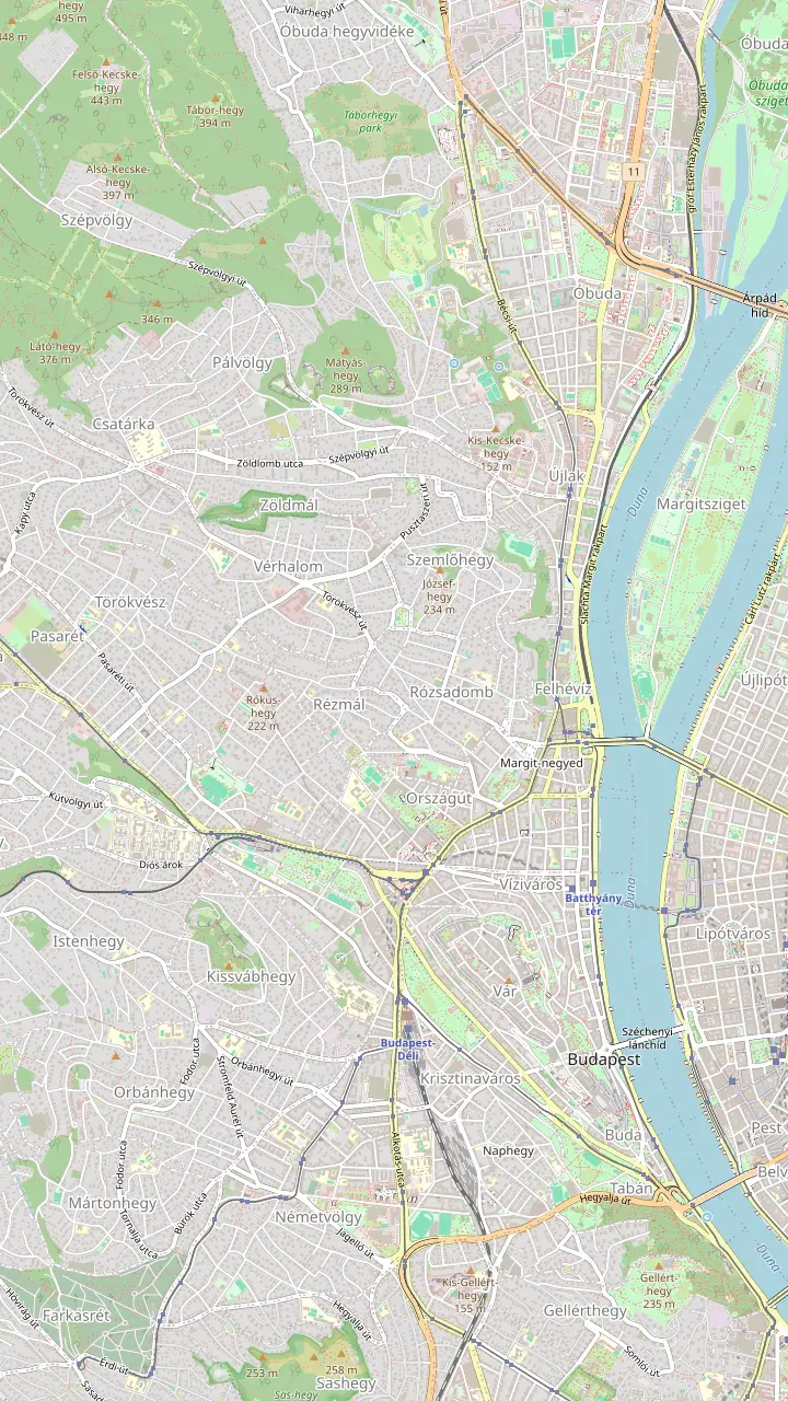
Short cave tour entrance at Dárda utca 2; tickets online only.
Google MapsWartime hospital and Cold War bunker, guided tours only, at Lovas út 4/c.
Google MapsSzemlő-hegyi, the step-free cave; closed on Tuesdays.
Google MapsPál-völgyi, the longest cave in Hungary; closed on Mondays.
Google Maps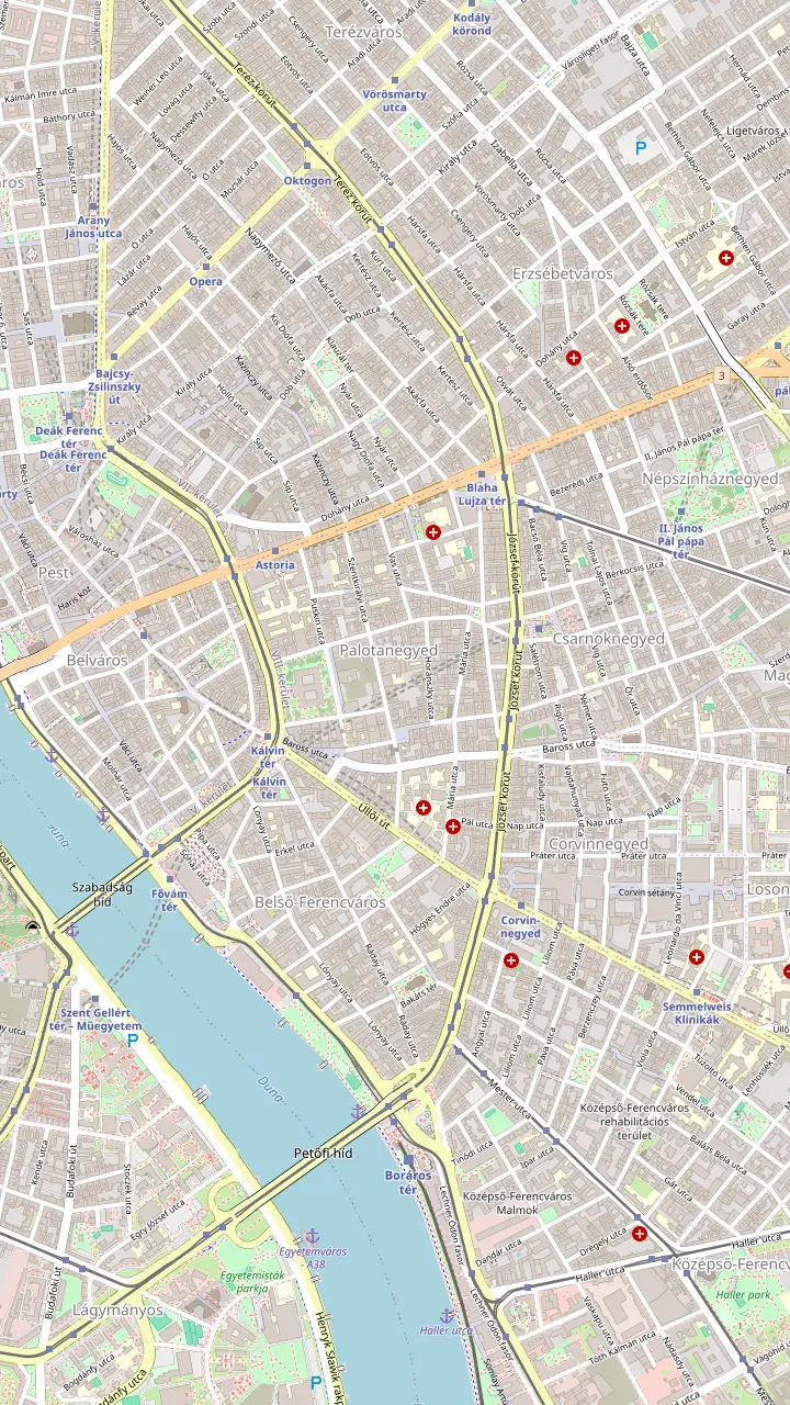
Otto Wagner's synagogue, reopened in 2021 with a kosher café.
Google MapsConsecrated on 6 September 1859; closed every Saturday.
Google MapsThe steel weeping willow by Imre Varga, behind the Heroes' Temple.
Google MapsHolocaust Memorial Center on Páva Street, open Tuesday to Sunday.
Google Maps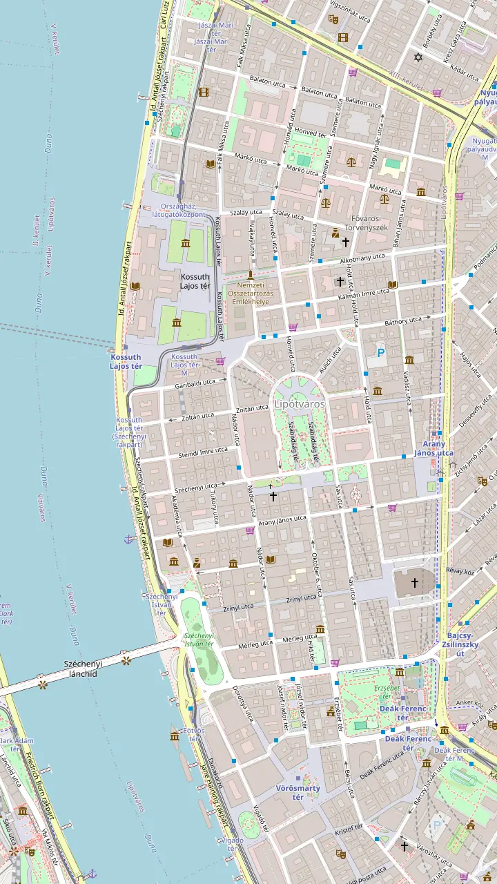
Budapest's largest church, 96 meters high; 364 steps or a lift to the dome.
Google MapsSquare in front of Parliament, framed by the old Ethnographic Museum and a ministry.
Google MapsHouse of Parliament, built 1885-1902; dome 96 metres.
Google MapsIron shoes remembering Jews shot into the Danube by the Arrow Cross.
Google MapsBuilt 1839-1849, blown up in 1945, reopened in 1949.
Google MapsMaps © OpenStreetMap contributors
Use this Budapest walking tour map to walk the city on your own: a loop through Pest, across the Chain Bridge, up to Castle Hill and back, with the tickets, apps and timings that help.
Editorial team, budapestwalkingtour.click · Updated November 8, 2026 · Allow 8 min
Overview
Budapest splits neatly into Buda and Pest, and this Budapest walking tour map joins the halves into a single loop. You start in central Pest, walk to the Parliament and the river, cross the Chain Bridge, ride or climb up to Castle Hill and come back down to the water. Each stop is pinned on the map above, and the tab for this page shows the whole loop in order. Zoom in on any pin for its note and a link that opens the spot in Google Maps.
How long is it? For comparison, the tourism agency says guided free walks in the city usually cover 3-3.5 km and take 2.5 to 3 hours.1 Our loop is longer, because it adds the castle plateau, so plan for most of a day with stops, a lunch break and time inside a few sights. Split it across separate mornings if you prefer, with Pest first and Buda the next day, which also lets you catch both banks in good light.
Walk it in the order shown, clockwise, so you face the best views. You see the Buda skyline from the Pest embankment in the morning, cross the river at the halfway point and finish with the castle terraces and the sunset over Pest. Wear shoes with grip for the cobbles on the hill, carry water in summer, and pack a thin jacket for the wind on the bridges. Plan café stops along the way for breaks and refills.
Route legs
| Leg | From and to | Highlights | Tip |
|---|---|---|---|
| Pest centre | Vörösmarty tér to the basilica | Cafés, basilica dome | Lift for the dome |
| Parliament | Basilica to Kossuth Square | Parliament facade | Book any inside visit |
| Riverbank | Parliament to Chain Bridge | Shoes memorial, bridges | Walk the lower quay |
| Castle Hill | Clark Ádám tér to the plateau | Church, bastion, palace | Funicular or bus |
| Return | Palace gardens to Elisabeth Bridge | Bazaar gardens, river | Lift down from the palace |
Legs follow the map panel for this page; the funicular, bus and lift options are as BKV and the tourism agency list them.8,9,16,4
Start on Vörösmarty tér in the heart of Pest, a square lined with cafés where the Gerbeaud café has its home. Order a coffee, get your bearings on the map and set off before the tour groups arrive. From there the Budapest walking tour route heads north through quiet streets to St Stephen's Basilica. The basilica rises 96 meters and is the largest church in Budapest.10 It took 54 years to build, and 3 architects left their mark on it.11
Climb its 364 steps, or take the lift, for a view over the rooftops toward the Buda hills.4 If you are here on a Monday evening, the basilica hosts organ concerts.12 Its square has a story too: when the great flood of 1838 swept through the city, people sheltering on the higher ground here survived, and they later gave money for a church on the spot.13 Look for the square's benches if you need a pause before the next leg.
From the basilica, walk west and north toward the river until the Parliament appears at the end of the street. In front of it lies Kossuth Square, with the former Ethnographic Museum and the agriculture ministry facing the Parliament.5 The Parliament's dome rises 96 metres, the same as the basilica, so neither building stands taller on the skyline.14,10 Stop here for photographs, then head down to the water.
Turn south along the riverbank. A short way down from the Parliament, on the edge of the quay, are the Shoes on the Danube Bank, the cast iron shoes that remember Jews shot into the river by the Arrow Cross.6,19 Slow down here and walk past quietly. A separate page on this site tells the memorial's story. Keep cameras low and voices soft as you pass, and give way to anyone standing in thought.
Continue south on the lower embankment, which the tourism agency describes as flat asphalt by the water, all the way from the Parliament.16 Ahead of you, the Chain, Elisabeth and Liberty bridges line up across the water, each appearing in turn as you walk.20 On the far bank, Castle Hill fills the skyline, its church spire, bastion turrets and palace dome strung out along the ridge.
For decades the Chain Bridge was the city's sole fixed river crossing; it went up between 1839 and 1849 to the design of William Tierney Clark.21,22 Sculptor János Marschalkó carved its four stone lions, and a long-told story says he forgot their tongues; peer into their mouths and you will find them.23,7 Retreating German troops blew the bridge up in 1945, and it reopened in 1949.24,25 A renovation began on 16 June 2021, and its 1,180 lamps are now LEDs.26,27
Alone or guided
Your pace and curiosity decide this one.
If I want freedom and my own pace
Walk this loop alone
Sights cluster closely and the map shows each stop in order.
If I want stories, not just sights
Join a guided walk
The landmarks walk runs 2 hours with a live guide.
If I want to see both banks with help
Take the orientation walk
It covers both Buda and Pest in 3 hours.
If I want courtyards I cannot enter
Book a specialist tour
Some paid tours reach places you could not access alone.17
If I plan many museums
Buy a Budapest Card
It includes transport and 40 free attractions.18
If you want a guide
Large group
Pest centre on foot
Both banks
Both banks with a guide
Buda side
The castle plateau
On the Buda side you land on Clark Ádám tér, at the foot of Castle Hill. The funicular's lower station is right here, and BKV runs it from 08:00 to 22:00.2 Its cars climb every 5-10 minutes, so a missed car is no great loss.67 The upper station leaves you on Szent György tér, in the middle of the district.33 Buy a single ticket at the station if you plan to walk down later, since the views on foot are better going downhill.
Prefer not to pay for the ride? The funicular's lower station is also on the route of buses 16 and 105 and trams 19 and 41.63 Buses 16, 16A and 116 stop by the upper station, so a public transport ticket gets you to the top as well.8 On odd-week Mondays during maintenance the funicular may be shut, so have the bus as a backup.65 Check the BKK app for the next departure before you walk to the stop.68
Walking up is free and short, though steep. The paths and stairways from the river reach the walls quickly, and every turn gives a new view of the Chain Bridge and the Pest bank. Take it slowly in summer heat and hold on to handrails on wet days, when the old stones turn slippery. You reach the top with the city spread out below you, which feels earned in a way the funicular never does.
Price a guided walk
Set your group size and compare city walks.
3 options compared
Set your group size and compare city walks.
≈
View≈
View≈
ViewStarting prices as on the booking platform, converted at the ECB reference rate. You see the exact price at booking.
The loop in order
Vörösmarty tér
Coffee on the square, then north to the basilica.
St Stephen's Basilica
Steps or a lift lead to the view.4
Parliament
Framed by the old museum and the ministry.5
Danube bank
Pass the Shoes, then walk south to the bridge.6
Chain Bridge
Look for the tongues of the stone lions.7
Castle Hill
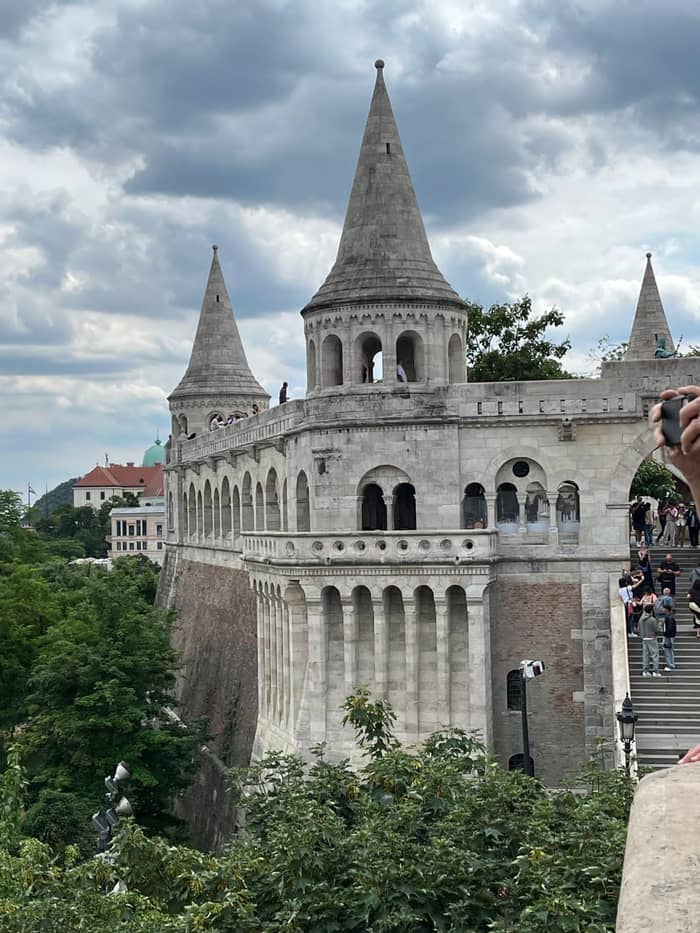
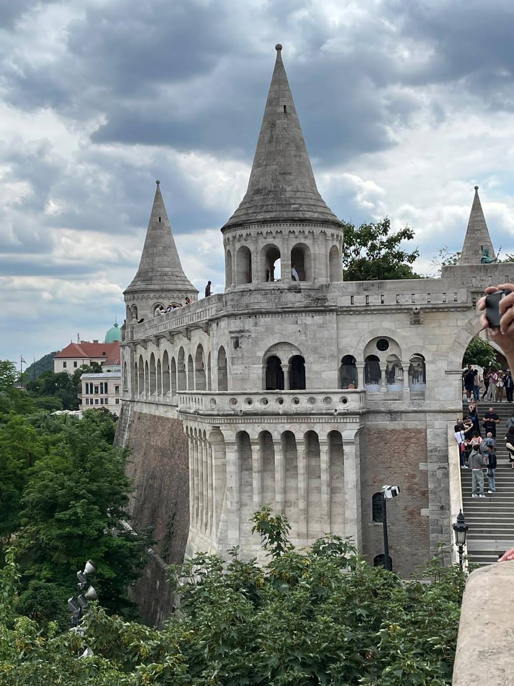
Once on top, walk north along the plateau to Holy Trinity Square. Matthias Church sells entry tickets, with the adult price at 3,400 Ft, and the tower is a separate ticket for a fixed time.29,69 The Fisherman's Bastion next door has a 140 metre facade facing the river, so walk its length for the classic view of the Parliament you passed earlier.31 From here you can trace your morning route along the far bank.
Then turn back south through the medieval streets to the palace. Hungarian painting and sculpture fill the National Gallery, the country's biggest public collection of its kind, and you exit onto a terrace facing Pest.34,35 After sunset, coloured lights pick out Strobl's hunting scene of King Matthias at the fountain in the Hunyadi courtyard.36,37 For the full detail on every sight, the Castle District guide on this site goes stop by stop, with tickets, hours and the history of each building.
To come down, leave the palace by its southern side toward the Castle Garden Bazaar, the riverside gardens designed by Miklós Ybl and restored between 2011 and 2014.39,40 A lift from Palace Road serves the Csikós Courtyard below the palace, which saves your knees on the way down.9 At the bottom you are by the river again, near the Elisabeth Bridge, ready to cross back to Pest or to rest on a riverside bench before the final leg.
Video
Walking The City on YouTube · Tap play to load the video; not before.
choose the lower embankment in Pest, which offers a straightforward route from the Parliament heading south toward Müpa Budapest
Pack and prepare
Cross the Elisabeth Bridge to return to the Pest centre and close the loop, or extend the day. Gellért Hill rises just south of the bridge, topped by the Citadella and its Statue of Liberty, which with its pedestal rises 40 metres above the hill.15 The fort's interior is not open, but the view from the hilltop over both banks rewards the steep path.70 Allow extra time and water, as the climb is harder than the castle approach.
For a greener extension, head north to Margaret Island, where a rubberised running and walking track loops for about 5.3 kilometres between the river's arms.71 It is flat, traffic-free and good for a slower afternoon among lawns and old trees. Or walk up Andrássy út from the city centre, an avenue completed in 1896 that is part of a World Heritage Site with the Millennium Underground and Heroes' Square.72,62
The underground line beneath that avenue, the M1, opened in 1896 as the first metro on the European continent, and riding it back saves tired legs.73 Whichever extension you choose, keep the loop flexible. Budapest's sights cluster closely, and the map lets you cut corners whenever the weather turns or your feet complain, without missing the views that make the walk worthwhile. On a hot day, saving the hill for the evening is often the smartest move.
A self-guided walking tour of Budapest is easier with a phone. BKK, the city's transport authority, offers journey planning, tickets and service updates in a single app, and a bankcard works as a validated single ticket.68,3 Matthias Church's audioguide runs on your own charged smartphone, and the church provides free Wi-Fi.66 The national park's cave app speaks English among other languages.74
If you plan several museums, consider the Budapest Card. You can buy it for 24, 48, 72 or 96 hours, and it includes unlimited public transport and 40 free attractions, and gives 10-25% off at many restaurants, cafés, museums and baths.64,18,75 Count up the entry fees on your list before buying, since the value depends on how many paid sights you visit. A walker who mostly stays outdoors may do better with single tickets.
When is a guide worth it? Free tours show the sights from the outside, with no entrance fees included.76 Some paid tours are led by specialists and take you into courtyards you could not enter alone.17 The walk sold on this page lasts 2 hours, with groups of up to 30, and does not enter the basilica; it is listed from €3. A 3-hour orientation walk covers both Buda and Pest from €36.
FAQ
The sights sit close together; for scale, a typical guided free walk is 3-3.5 km and lasts 2.5 to 3 hours.1
The 2-hour landmarks walk passes the basilica but does not enter it.
Sources
Walking Budapest soon? Ask a real person here.